Attention all Special Collections and Archives supporters!
As many of you may have seen reported in the Arizona Daily Sun, the Arizona Board of Regents approved multiple large-scale projects on Northern Arizona University’s Flagstaff campus at their September 25-26, 2025 meeting. These projects will both involve Cline Library in some way. The new building for the College of Nursing will relocate faculty and classrooms currently housed in buildings slated for demolition to the library, which necessitates renovations. Additionally, the library’s heating, ventilation, and air conditioning (HVAC) and fire life safety (FLS) systems will be renovated and upgraded.
The latter project directly affects Special Collections and Archives’ collections storage area, impacting our ability to conduct business as usual. As we prepare for the construction phase of the project, SCA is no longer able to accept donations of archival or published materials as of May 20, 2026.
At this time, the pause in collecting will be in place until at least January 2029, when we anticipate being able to re-engage prospective donors in conversation. In the meantime, please do not mail or drop off materials for donation as we are unable to address them responsibly. Unsolicited donations will be considered abandoned property and may be discarded.
While there is not yet a firm timeline for the completion of the HVAC/FLS project, we will be sure to share updates regarding its progress as they become available. We appreciate the understanding of the Flagstaff and Colorado Plateau research community during this time, as we focus our efforts on protecting the valuable collections we are proud to steward for future generations.
Watch this space for changes and more information!
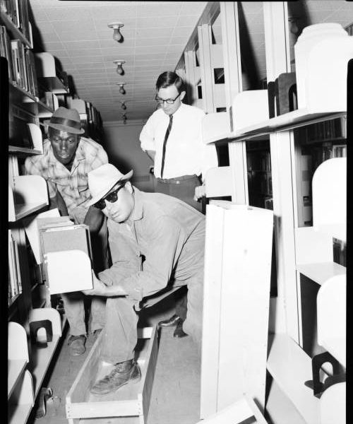
NAU.ARC.1966.2.9 Workers move the library collection from the Gammage Building to the new library, April, 1966
May 21, 2026
by special collections & archives Comments Off on Summer Hours and New Reference Model
Special Collections and Archives is now on summer hours and will be transitioning to a by-appointment-only model for reference services.
Special Collections and Archives summer hours will be Monday through Thursday from 8:00am – 5:00pm. The department will be closed on the following holidays – Memorial Day (5/25), Juneteenth (6/18) and July Fourth (7/2).
In order to better serve our patrons, Special Collections and Archives is transitioning from a walk-in reference model to an appointment-based service model. This is a strategic response to limited staffing and evolving institutional priorities, which will allow us to deploy staff more efficiently to support our patrons’ research and reference needs, and allow us to more effectively serve our patrons by having materials pulled and prepared for their appointment. This will be a permanent change that will be in effect starting on Monday, May 11, 2026. To make an appointment, email us at specialcollections@nau.libanswers.com or call us at 928.523.5551.
Thank you and we look forward to working with you!
August 19, 2025
by special collections & archives Comments Off on Wrapping Up with Niko Bare
What surprised you most about the summer 2025 Reilly internship, or the David Muench Photography records?
My lack of imposter syndrome coupled with feeling like a fetus at all moments. I expected to be more overwhelmed by the scope of either David’s work or my own responsibilities. While doing it all together was new, the individual tasks to get the end goal of complete exhibit was stuff I’d done at least a few times before. Once I stopped thinking further than my feet could get me, it was easier to get moving. Rather than being as daunted as I’d expected by the culmination of an entire life’s career placed directly in front of me, I found myself curious. Mostly because I sat there thinking about my abysmal storage situation (none) for my far bigger paintings and what that would look like in 10 years.
I was surprised there wasn’t more dissonance between my artistic woo woo whatever approach to things and the analytical minds I’ve been surrounded by. Sure, I’ve had to explain some artsy terms, but there haven’t been fundamental misunderstandings of what I’m suggesting or talking about, only suggestions to be more realistic or clear. My assumption is that’s because I’ve got a more science/math brain than I want to admit, and art is an inherently human thing to enjoy and create, so therefore most everyone’s got some form of appreciation.
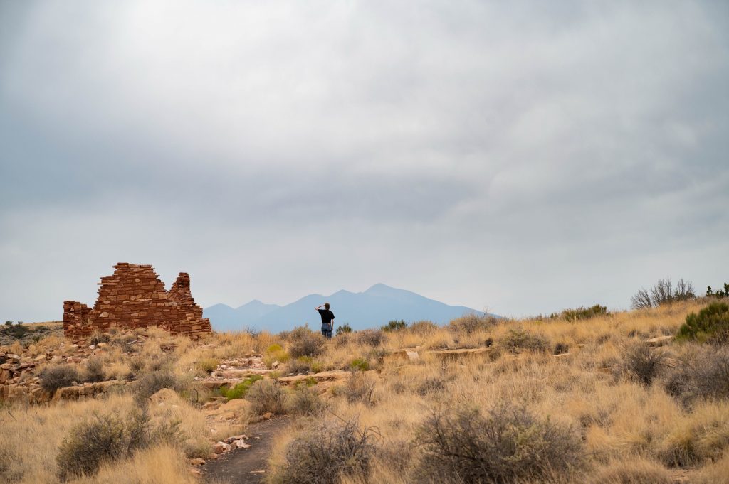
Niko at Wupatki National Monument.
What do you hope people will take away from viewing the exhibit, whether online or in person?
David Muench’s work has masterful use of design elements, which I’ve called attention to through my selections and think could be helpful for someone studying art and its principles. Ideally, the relationships between pieces make sense and reveal things that wouldn’t have been highlighted if they were displayed separately.
I hope that I’ve stayed true to David Muench’s intent of fostering a love for the environment and the landscapes we interact with on a daily basis. It’s my wish that this selection makes viewers want to explore places on their own, especially the variety we’ve got in Arizona and around Flagstaff. It’s certainly made me want to explore despite always choosing to lock myself in the painting studio instead.
What was your favorite task or step during the internship? What was your least favorite?
I really enjoyed arranging the two spaces, Scholars’ Corner and the SCA gallery space, and the different challenges they presented, the groupings that would present themselves based on the layouts. In Scholars’, there’s only one wall that would be suitable to a pair of images and therefore most selections are individual. In the actual gallery space, there were a lot more relational decisions to be made. This is only exciting to me, but I’m glad I got to mess around with different label types. I’ve previously done scuffed, handwritten labels for a guerilla exhibit and the standard white rectangle of information for the normal ones. I’ve installed bigger vinyl and have designed numerous things in Adobe Illustrator. How hard could tiny vinyl labels be? Graphic design is not my passion; it is the bane of my existence. And yet, it is one of the most useful tools I’ve picked up in my life. The rewards for my efforts are always worth wanting to ram my head through the nearest wall for a few hours.
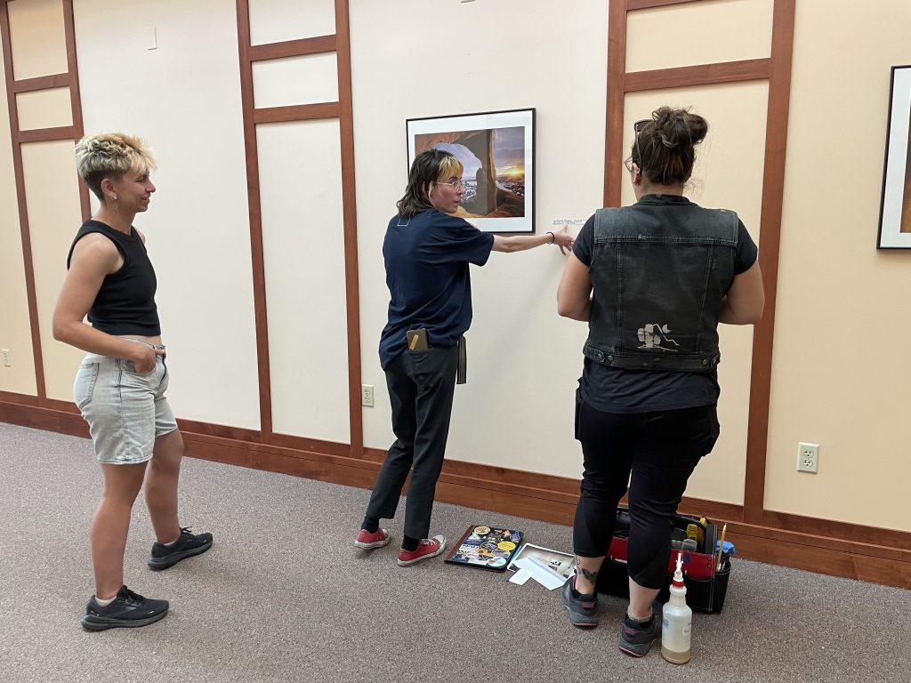
Sam, Niko, and Sara de la Rosa from NAU Printing Services discussing vinylplacement.
How has this internship informed your academic career at NAU? How does what you learned this summer connect to your studies?
This summer has built upon some of the experiences I’ve had curating, and serves as a real-world application of the processes we’ve been mimicking and following in courses. I’m finding it all feeds into each other. The courses and skills subsequently learned prepare me for opportunities like this one, which allow all my knowledge bases to work together. This is true not only in terms of requirements, but also how my art history knowledge has been able to inform both the artistic and academic sides of my career. Understanding the processes of creating the art or material I’m working with helps me better inform the audience about the piece and notice small details, things of this nature.
I had never done anything substantial with websites before and certainly not for exhibition design. While I don’t think I’m going to be a website wizard, knowing how to design a layout that’s navigable (and pretty!) and how to display information in an accessible way is very important in this day and age, especially in the public-facing field I’ve chosen to pursue. Websites and social media will inherently have a bigger reach than a physical event or something promoted locally, which means I’ve got to stop pretending I’m living in the ’90s.
Did the internship experience help you clarify anything about your future career or possible work experience you hope to gain before or after graduating?
While the internship experience hasn’t drastically changed my ideal career (it was already in this vein), it certainly showed me there are lots of ways to get there, which makes me less concerned about taking the “correct” path and more concerned about the path suddenly no longer leading where I thought and ending up in a town I’ve never heard of. But I suppose that’s already happened; I’m a graphic designer turned painter attempting to convince himself and others he can be taken seriously when talking about his practice. Truthfully, had you told me this is how I’d be spending my summer when I signed up for the PFA gallery last fall, I would have asked you if the ceiling had also collapsed and you just dug yourself out of rubble. I’m stoked to not have been proven wrong or come to the realization that I hate thinking about display and audience engagement and subtle design choices before that’s what I’m trying to do for 40+ years. I feel less like I must choose between art and academics, and less like I have to know how to balance them immediately. You know, both relieving and a whole other set of problems.
Anything else you’d like to share about your experience?
This internship has been one of my favorite experiences NAU has offered me, or rather that I’ve worked towards. I evidently enjoy struggling with new things, and therefore all of the digital stuff was a fun, frustrating puzzle for my materially minded self. I’ve never had as much control over an exhibit as I have for this one, which forced me to trust myself and my visual eye. It’s done a lot of good for pushing my skills further, gathering new ones, and my confidence in my ability as a curator and as a writer.
Congratulations, Niko, for putting together a great show! David Muench: The Allure of Light will open September 2nd, 2025, in Cline Library Special Collections & Archives.
July 9, 2025
by special collections & archives Comments Off on From the Desk of Niko Bare, Summer ’25 Reilly Intern
We are about halfway through my internship, and I am really enjoying my summer in Flagstaff. I thought everything bloomed in the springtime but, as my allergies would tell you, everything is beautiful and vibrant and making me sneeze. The David Muench Photography records keep me incredibly busy, and I’m glad for it. I get to emerge from temp-controlled, buzzing fluorescents into the warm sunlight that makes me want to travel to the places I’ve been studying in images.
On that note, it has been rewarding when digging through hundreds of images of the same area to find the exact image (composition, framing, time of day) I’m looking for. Basically, I’m a bit of a guinea pig making sure that, from thousands of photographs, specific originals can be found from the finding aid with relative ease. More generally, I’m able to sharpen my curatorial eye and work on more behind-the-scenes tasks such as labels and supporting text, high quality digitization, layouts, metadata, etc. All the tasks that go into making an exhibit feel fluid and intentional while not drawing attention to itself. My entire job with a fine art exhibit is to offer threads for further exploration without taking away from the art, the star of the show. My main question is how do I give searchable information to researchers looking for it while not intruding on the experience of those trying to enjoy the image.
There’s great value in delving into a single artist’s body of work, whether contextually or as a standalone experience. Often we, as students, are exploring a movement of art or a couple of heavy hitters the public is already familiar with, but the attention to a specific artist’s obsessions and techniques has been exciting. I got a taste of this type of specific artist research through my coursework and it is both overwhelming and exhilarating to have boxes upon boxes, rows upon rows, to search through. In my gallery experience, usually the pieces and statements are already picked out and the challenge is how to arrange and design around them. I’m taking it a step further and not only arranging but also selecting the work and writing about it.
I have found the time management, manageable but difficult. It’s challenging to make sure that everything is done that needs to be and that everything else is steadily making progress. The timeline really gives me no space for hesitation, which is good and bad. I have to trust my instincts and work fast while also trying to catch anything that might cause issues down the road or solve issues that popped up. While daunting, these challenges are also exciting as they help to inform future research challenges. I’m always interested to see how different people are interacting with and interpreting different problems or even aesthetics. When I get overwhelmed with the volume of images I could chose from or whatever task, I find it helpful to step back and see how the team is responding or what their input or experience is. It’s also been beneficial when I’m swimming in a certain task to have someone ask a question which diverts my attention away from it and towards something else of importance. While the workload is larger than I’m used to, there is a large support group working me through that.
June 24, 2025
by special collections & archives Comments Off on Welcome Kaylen Wilson, SCA’s Route 66 Centennial Exhibit Intern!
Hello! My name is
Kaylen Wilson, and I am a graduate student in the History program here at NAU.
I am super excited to be interning at Cline Library for the Route 66 Centennial
Celebration Exhibit!
I grew up in the town of Taylor, Arizona, about 120 miles from Flagstaff. Growing up, driving to Flagstaff for the day always felt like a huge occasion, but looking back on it, I never really realized how much of that drive followed Route 66! It was such a regular part of my life that I didn’t realize just how special it is and was for years. When I came to Flagstaff to attend NAU, I started to see Route 66 advertised all over town and hear stories about traveling the road. I also gained an academic interest in studying the history of tourism locally. Those experiences really changed my perspective on the road! I think this exhibit and internship are a great opportunity to reach out to both those who love Route 66 and to encourage people who aren’t very familiar with it to appreciate the people, places, and stories that make it special.
Photo courtesy of Kaylen Wilson.
I transferred to NAU from Northland Pioneer College in 2022. Looking back on it, I think choosing a university in northern Arizona quickly made it feel more like home for me. I also love the outdoors, so having so many hiking trails close by definitely impacted my decision! I grew up traveling to national parks throughout the American West, and my experiences there gave me a love for talking about history. I am pursuing a Master’s degree in History with an emphasis on Public History so that I can learn to share that passion with others. I think that learning local history and gaining experience with exhibit design during this internship will definitely help me enter the public history field and tell meaningful stories once I graduate!
June 9, 2025
by special collections & archives Comments Off on Introducing Niko Bare, SCA’s 2025 Reilly Intern
Special Collections and Archives is honored to introduce Niko Bare as the Elizabeth M. and P.T. Reilly intern for the summer of 2025. Niko will be working closely with SCA staff to develop a physical display and virtual exhibit showcasing images from the David Muench Photography records. Niko is a rising senior at Northern Arizona University (class of 2026), majoring in Studio Art with an emphasis on Painting while pursuing both a Museum Studies and an Art History minor.
Niko previously interned at NAU’s Beasley Gallery in the School of Art and Design, where he assisted with exhibit installation and curation. They have exhibited their own work at the Beasley Gallery as well as through the Episcopal Church of the Epiphany’s Art in Action program. He also volunteers at the Museum of Contemporary Art Flagstaff (MOCAF).
We caught up with Niko at the end of their first week in SCA to learn more about their background and what they hope to learn this summer.
Tell us where you’re from and why you chose NAU.
I’m from the Chandler area, just south of Phoenix. I chose to come to NAU mostly for the trees and change in climate. It has been really wonderful to get to know a new place with so much history boiled in.
What are you studying at NAU?
I’m studying Studio Art, specifically painting, as well as Museum Studies. I find the balance between the practice of art and the history and presentation of it to work hand in hand.
Niko standing in front of a Edgar Degas painting. Photograph courtesy of Niko Bare.
What are your plans after NAU? (If you’ve made any at this point!)
I would love to go to graduate school for either museum studies or fine art. The end goal is working in some sort of museum/library/gallery adjacent area while being a professional artist on the side. Don’t ask me how I’ll have time for that.
What interested you about the Reilly internship?
The thing that drew me to this internship most was its subject matter of fine art and the opportunity to do a ton of research about it. I’m interested to see how different organizational systems work. Learning how to put together a digital exhibition is an exciting challenge as I’ve previously helped curate physical ones. The intersection between art and science is something I’ve been mulling over for a while, and I’m always trying to see how they interact.
What are you hoping to learn from the experience?
I’m hoping to gain experience in a more academic curatorial setting. I’m super interested in archival processing and handling as well as digitization and access to materials. While I think I’ll end up in a more curatorial or research setting, I have always been interested in the inner workings of libraries.
Are you more of a cat person or a dog person… and why?
I would say I’m more of a dog person only because I’ve only ever lived with dogs. They’re always following you around and I love that you can tell when they have favorites in the household. My roommates have cats and I will say I do enjoy having mischievous creatures around.
May 5, 2025
by special collections & archives Comments Off on Celebrating SCA’s Graduating Seniors
As the semester comes to a close and excitement gathers around this week’s commencement ceremonies, Special Collections & Archives would like to congratulate our three Student Assistants who will be graduating as part of NAU’s Class of 2025!
Max Schrader | Anthropology, Museum Studies
Max joined the SCA Student Assistant team in the fall of 2023. Over the past two years, he has worked with SCA staff to process the David Muench Photography records, our biggest photographic acquisition to date.
Max has worked closely with Sam Meier, Archivist for Discovery, Melissa Lawton, Archivist for Collections Management, and Erin Carter, Libraries Assistant Manager for Archival Processing, to physically process materials in this collection. In his time with SCA, he has rehoused countless 4×5 transparences, sifted through business records, inventoried a wide variety of material formats, and ultimately provided invaluable support.
“I most enjoyed being able to work with SCA staff on different components of the project, from considering materials used, to considering relevant metadata, to learning about digitization and the research interests of the Colorado Plateau. It was also a strange and incredible experience to become so intimately knowledgeable of one man’s life and career while never having actually met him.“
As the David Muench Photography records have taken shape, Max has expanded his archival skills into the new age. Most recently he has worked with Kelly Phillips, Archivist for Digital Programs, and Jess Vogelsang, Library Coordinator, to digitize photographic selections from the collection. Utilizing the DT Atom imaging system, Max has created high-resolution digital surrogates of some of Muench’s lesser-known work.
Caroline started in SCA in the fall of 2024 and has been working with Sam Meier and Erin Carter to process collections out of SCA’s backlog. This year, she was able to physically process and create finding aids for over 16 collections that were previously unavailable to researchers!
Through working on these collections, Caroline has learned about how collections are appraised and processed. She has also learned how to write Describing Archives: A Content Standard (DACS) compliant finding aids in ArchivesSpace and Encoded Archival Description (EAD). These skills are foundational to the arrangement and description realm of archival work, and the collections Caroline has made discoverable are a testament to her ability to move from physical processing to archival description with ease.
“I enjoyed processing [Stephen Hirst’s] multiple formats…collections materials also included many gorgeous photos from Havasu Canyon and of many Havasupai people. It was awesome to see these images and be able to add many [of the] subjects’ names to the public-facing finding aid, ensuring that tribal members will be able to re-discover these images in the years to come.“
Two standout collections from Caroline’s work that demonstrate the diversity of the materials she has worked with this year are the Stephen Hirst papers and the Steve Dudley papers. The former centers on Hirst’s work with the Havasupai Tribe and includes many material formats like photographs, VHS tapes, and maps; the latter contains photographs and training materials related to Dudley’s decades in fire management in Coconino National Forest. Caroline’s work this year has been of great help to our ongoing efforts to increase the accessibility and discoverability of our collections.
Jordan Bohn | Anthropology
Jordan joined SCA in the fall of 2024 and has worked closely with Melissa Lawton to assess and inventory materials in SCA’s vault storage space. The vault is used to store more high-risk material formats like photographic negatives, film reels, and audio cassettes.
As space is always at a premium in the world of special collections and archives, Jordan’s inventory of the vault is helping us map out ways to maximize the space we have. She also completed an inventory of collections in our regular storage, and both of these endeavors will help inform how we approach both space and materials management.
“I loved getting to see cultural materials in a new way, not just bones or pottery sherds or projectile points, but sweet photos of Katie Lee and her cat, photos of early Flagstaff, 3D materials like knives, buttons, stickers, and postcards. I think my favorite photo I ever got to see was that cat and the porcupine hanging out together in the Dick Sprang collection.”
In addition to her collections management projects, Jordan took on some arrangement and description tasks. She processed the Lou Kokonis photographs, a collection that features National Parks and landmarks from all over the west, and the Dick Arentz Four Corners Country photographs, taken while compiling images for his 1986 publication.
Jordan will be pursuing a Master of Arts in Library & Information Science at the University of Arizona this fall.
Congratulations Max, Caroline, and Jordan! Thank you for all the hard work you have put into your time in SCA. We look forward to seeing where the future takes you all!
January 23, 2025
by special collections & archives Comments Off on Spotlight on David Muench Photography: 2025 Reilly Internship
Antelope Canyon, Glen Canyon Recreation Area / Lake Powell area, slot canyon (sandstone), Arizona, United States, circa 1970s. David Muench Photography records. AB-867. JPEG created circa 2014 from original 4×5″ photographic transparency.
Elizabeth M. and P. T. Reilly Exhibit Internship
Position type: Internship
Location requirements: Onsite, Flagstaff, Arizona, United States
Job description: Job Vacancy Number: 9612268#
Saguaro National Park, rainbow, desert storm, Arizona, United States, circa 1987-1988. David Muench Photography records. P-9407. JPEG created circa 2008 from original 4×5″ photographic transparency.
Position Overview
Northern Arizona University’s Cline Library invites applications for the 2025 Elizabeth M. and P. T. Reilly Internship. The intern will work closely with Special Collections and Archives (SCA) staff to develop a photographic exhibition showcasing images from the David Muench Photography records. The Reilly internship is an opportunity for the intern to research, curate, and design both a virtual online exhibit and a physical display which will launch in October 2025.
The David Muench Photography records, acquired by SCA in 2022, document Muench’s 70-year career in landscape photography. Muench is best known for his work in the American West, including his numerous collaborations with the National Park Service and his contributions to Arizona Highways. The David Muench Photography records encompass thousands of physical and digital images created by Muench as well as associated business records and other materials.
SCA envisions the exhibit as representing highlights from David Muench’s photographic career, including selections from his most iconic images. The intern will select 16 to 18 images from the collection highlighting the distinctive aspects of Muench’s work. They will assume primary responsibility for researching and writing content for the physical display and virtual exhibit, bearing in mind that past online exhibits are preserved for long-term online enjoyment. The intern will collaborate with SCA staff to design and prepare for the installation of the physical display in SCA’s gallery space on the second floor of Cline Library. The intern may also assist in the design of satellite exhibits in other locations.
SCA is one of the most comprehensive repositories of Colorado Plateau history and culture. SCA’s 600+ unique archival collections contain millions of photographs, correspondence, journals, maps, films, and oral histories that document the human and natural history of the Colorado Plateau from a variety of perspectives from the 19th century to the present. The Reilly internship supports NAU’s 100% Career Ready strategic initiative and recognizes the importance of the eight NACE career readiness competencies. By collaborating closely with SCA staff to conceptualize and execute the exhibition, the 2025 Reilly intern will establish collegial relationships with information professionals and gain insight into the GLAM (galleries, libraries, archives, and museums) field.
Learning Objectives
Research using archival (primary source) and published materials
Selection and curation of photographic images
Collaborative, team-based exhibit planning and preparation
Schematic exhibit design for the physical exhibit, text design, installation preparation
Website design, website creation, and digital exhibit design
Duties and Responsibilities
With the support of site supervisors and other SCA staff, the Reilly intern will conduct research utilizing the David Muench Photography records and the David Muench Research Library, leading to a highly selective representation of images for inclusion in a physical display. The images will include selections from original framed items from the collection.
To complement the physical display, the Reilly intern will develop a companion virtual exhibit using WordPress. The virtual exhibit will offer a narrative overview of Muench’s photographic career and provide additional context for selected images, helping the intern gain valuable digital storytelling skills. The intern may draw on other archival collections or published resources to develop the virtual exhibit.
The intern will create and write exhibit text for the virtual and physical exhibits. They will assist in the design and layout of text for the physical exhibit, primarily the exhibit title and object identification labels or brief captions.
The intern will collaborate with SCA staff members to determine appropriate display locations and conditions for original framed material from the collection. The intern will learn about light exposure, light control, and other damage and risk factors related to exhibition.
The intern will assist with preparatory work for the installation of the physical exhibit. These tasks include determining the desired layout of selected images and working with SCA staff to support the fabrication and printing of exhibit text and images.
The intern will gain insights into budgeting for exhibitions through conversations with SCA staff regarding fabrication costs.
The intern may assist in the design of satellite exhibits in other locations, such as Scholar’s Corner in Cline Library.
The intern may assist SCA staff with the identification and ingestion of born digital material for the exhibit into the Colorado Plateau Digital Collections (a CONTENTdm instance). Through collaborations with SCA staff regarding digital material in the collection, the intern will gain insights into digital asset management in a library or archival setting.
The intern will gain skills in clear, organized, written and verbal communication to report their work progress and processes to SCA staff and to coordinate work tasks.
In conducting research for the exhibit, the intern will employ critical thinking strategies to gather and analyze information from diverse sources, including archival collections, published materials, and other resources held by SCA and Cline Library.
The intern will be expected to demonstrate dependability, prioritize and complete assigned work tasks, and show attention to detail in all work products.
Internship Length
The Reilly internship will run for 10 consecutive weeks between May and August 2025, with specific dates based upon the successful candidate’s availability. The successful candidate will work with the site supervisors to establish a start and end date for the internship upon acceptance of the position. The workweek schedule offers some flexibility, but in general the intern will be expected to work 40 hours per week: 32 hours onsite during SCA’s summer hours of Monday-Thursday 8 AM – 5 PM, and 8 hours of offsite remote work on Friday.
Compensation and Housing
The pay rate for the Reilly internship is $17.25 per hour (non-benefits eligible), 40 hours/week, not to exceed $7,000 in total.
This is an onsite internship. The successful candidate must be willing to relocate to Flagstaff for 10 weeks and underwrite their own food, lodging, and transportation.
On-campus housing is subject to availability. For more information, please consult https://nau.edu/campus-living/summer-housing/. Renting a room in the community is also a possibility.
Position Qualifications
Education Requirements
The preferred candidate will be a highly motivated and organized undergraduate or graduate student in photography, communication studies, art history, museum studies, or a related field working toward a career in a gallery, library, archives, or museum setting. Students are required to be currently enrolled in an accredited program with an anticipated completion date of August 2025 or later.
Minimum Qualifications
Current undergraduate or graduate student with a program completion date of August 2025 or later.
Minimum GPA of 2.0.
Preferred Qualifications
Experience with or demonstrated interest in learning web design and virtual exhibit tools such as WordPress, Wix, Weebly, Omeka, etc.
Coursework in photography, visual communication, communication studies, art history, fine arts, or museum studies.
Excellent research and written communication skills; ability to synthesize and present key information succinctly.
Experience with or interest in curatorial work and/or exhibit development in a gallery, library, archives, or museum (GLAM) context.
Strong project management skills, including goal setting, time management, verbal and written communication with team members, and critical thinking, as evidenced through previous educational, extracurricular, or work experience.
Federal Work-Study eligible students are encouraged to apply.
Application Instructions
Application Deadline
Application deadline: February 27, 2025 by 11:59 pmMST.
Application Guidelines
To apply, please submit the following documents:
Letter of application addressing your qualifications for and interest in the position, including links to any previous relevant projects you have created/designed, with an emphasis on how the position will support or advance your studies and/or career path.
A writing sample of approximately 100-200 words, providing an example of exhibit text for an image featured on the David Muench Photography website (davidmuenchphotography.com). You may utilize various resources to prepare your text, including the website itself, Wikipedia, interviews with David Muench, etc. Please include a bullet list of sources utilized to prepare your text at the end of your writing sample. Include your writing sample in the same document as your letter of application.
Resume or vita which details relevant coursework, work experience, and includes names and contact information for three references.
Contact Sam Meier with any questions regarding the position or requirements for application materials: Samantha.Meier@nau.edu or 928-523-5811.
Equal Employment Opportunity
Northern Arizona University is a committed Equal
Opportunity/Affirmative Action Institution. Women, minorities, veterans,
and individuals with disabilities are encouraged to apply. NAU is
responsive to the needs of dual-career couples. EEO Law
Poster NAU is an Employer of National Service. AmeriCorps,
Peace Corps, and other National Service alumni are encouraged to apply.
September 12, 2024
by special collections & archives Comments Off on Digitizing the Mother Road
Thanks to generous funding from the Association, SCA was able to hire Adya to complete scanning of the Association’s newsletters in addition to digitizing scrapbooks, photographs, correspondence, Fun Run posters, and more. SCA caught up with Alcalde at the end of her digitization project to hear what treasures she found this summer.
Adya Alcalde digitizing scrapbook materials using SCA’s new DT Atom digitization platform, September 6, 2024. Photograph by Sam Meier.
SCA: Which item you selected for digitization is your personal favorite?
AA: It was my particular pleasure to digitize John E. Curran’s letter to Jerry Richard, which described his memories of the Mother Road as he passed over it in 1937. Curran’s letter spoke not only to the economic hardship endemic to the Great Depression—describing a bygone era with stark clarity—but also described the sense of perseverance I have come to understand as endemic to Route 66 and its communities themselves.
“It might have been Americas Main Street or the Mother Road but to me it will always be the HIGHWAY WITH A HEART.”
By showcasing the variety of jobs available in the late 1930s, the transience of life upon the road, and perhaps most notably, the supreme and dependable kindness of strangers, the letter encapsulated everything I had hoped to record about Route 66 and the Association in my selections.
SCA: What material was the most difficult to capture digitally, and why?
AA: Part of my summer role was to digitize the 14 scrapbooks in the Historic Route 66 Association of Arizona’s records on the DT Atom, a new piece of digitization equipment the department was still installing during my last semester as a student assistant. Learning how to operate the camera, which required a recalibration of shutter speed, exposure, and white balance each time I began a new session, proved challenging at first, but ultimately immensely rewarding. The images I captured were so sharp they could be enlarged to show the dusty or ink-stained fingerprints of Vince Salmon and Linda Hawn (who compiled the scrapbooks) recorded on the sticky side of the tape they used to attach articles to the paper, the halftone dots which made up the images in newspapers, and the uneven distribution of ballpoint pen ink.
A high-resolution scan of a newspaper clipping from one of the Association’s scrapbooks, enlarged to show the halftone dots from the printing process. September 6, 2024. Photo by Sam Meier.
As I worked on the scrapbooks, I also quickly discovered their bulkiness had much to do with Vince Salmon’s penchant for maintaining and enclosing full copies of magazines, newsletters, correspondence, and other materials (trail mix bags, packets of flower seeds) within them. Any piece of material which could not be photographed laying flat (which made up a significant portion of the scrapbooks) proved difficult to capture. My work to record them included unfolding complex arrangements of slowly disintegrating newspaper (with Salmon’s handwritten notes of “fold down” or “unfold side” or “rest of article on back” in various places over them), folding napkins backward from where they’d been stapled so I could photograph the handwritten notes on the side facing the scrapbook paper, and being eternally grateful for the DT Atom’s foot pedal, which functioned as a de facto shutter button when both my hands were occupied holding back pages of the Miss Route 66 Pageant brochures.
SCA: Looking ahead, how do you think these digitized materials could help tell the story of the Mother Road as we approach its centennial in 2026?
AA: Though the materials I’ve worked to digitize this summer display a wide array of activities, they all serve to represent the diversity of stories tied to Route 66. The materials in this collection document roadside attractions (Meteor City’s longest map of Route 66) and establishments (Seligman, Arizona’s “Havasu” Harvey House) which have long disappeared from the map: brought down by wind, rain, economic downturns, lack of business, or (on occasion) railroad executives disinterested in maintaining hundred year old assets. The ephemerality of these establishments and the people who ran them is stemmed by their preservation here, where razed buildings, departed executive vice presidents, and past eras live on in reproductions of photographs, personal testimonies, and fraying newsprint.
Angel Delgadillo and members of the Historic Route 66 Association of Arizona paint the world’s longest map of Route 66 at Meteor Crater, Arizona, 2002. NAU.PH.2017.51.047.004. Historic Route 66 Association of Arizona records.
The letters thanking Association members for returning lost wallets, the happy birthday messages typed in Association newsletters, and all the terrific photos of Jerry Richard playing with leftover props from the Universal Soldier set in Cool Springs effectively elevate Route 66 from patched slabs of asphalt to its stature as the force that engendered (global!) cultural change for nearly 100 years.
These materials provide means to consult with the history of the road. They also highlight the vitality of the people that established, traveled upon, daydreamed about, and preserved it.
I believe these materials serve as a testament to the enthusiasm, fondness, and dedication Route 66 has asked of me as a nascent historian of the road. It’s my hope they do the same for the many others able to enjoy them now.
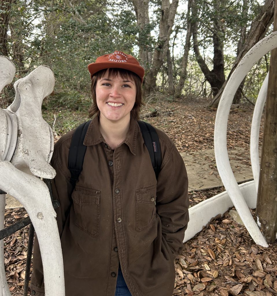
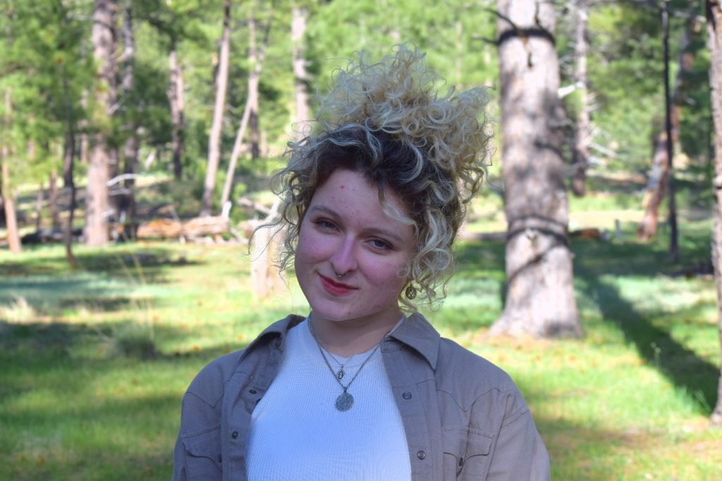
Alex Williams, 2024 Elizabeth and P. T. Reilly Intern Photo courtesy of Alex Williams
It is with great pleasure that we introduce Alex Williams as the Elizabeth and P.T. Reilly Intern for the summer of 2024. Alex will be working closely with Special Collections and Archives staff to develop a physical and virtual exhibit exploring the relationship between forests, forestry, and the communities in Flagstaff and northern Arizona. She will be a senior this fall at Northern Arizona University and is focusing her education on history and comparative cultural studies.
Alex is a Dorrance Scholarship recipient, serves as a peer mentor for the Dorrance Scholarship Program, and has been a Teaching Assistant in the NAU Department of Comparative Cultural Studies. She also volunteers at the Riordan Mansion State Historic Park, Cline Library’s neighbor, incorporating her research into the guided tours she leads for visitors.
We sat down with Alex as she settles into her first week to learn a little more about her NAU experience so far and what she’s looking forward to as the Reilly Intern.
Tell us where you’re from and why you chose NAU.
I’m originally from Phoenix, AZ. My interest in the environmental sciences and forestry initially drew me to NAU. I had heard excellent things about the NAU forestry program and initially projected my degree plan to be in forestry with a certificate in wildlife management. That is, until I discovered my love for the Humanities midway through my undergraduate experience.
What are you studying at NAU?
I’m now pursuing a Bachelor of Arts in Comparative Cultural Studies and a Bachelor of Science in History with minors in Museum Studies, Classical Studies, and emphases in Art History and Environmental Humanities.
What are your plans after NAU?
After graduating from NAU I plan to pursue my master’s degree in museum studies or a similar degree. I’m interested in a future career in museums, archives, libraries, and historical societies. I hope to continue my studies with a historical and environmental emphasis.
Photo courtesy of Alex Williams
What interested you about the Reilly Internship?
Where shall I start? This internship brings together my various interests in history, museum studies, and forestry in a very meaningful way. After becoming a volunteer tour guide at Riordan Mansion State Historic Park and joining the NAU Logging Team during my forestry days, I learned so much about Flagstaff’s local history, both in the environmental and human aspects. Yet, I quickly found that so many Flagstaff locals didn’t know their local history themselves; many don’t even know why the NAU mascot is the lumberjack in the first place. This internship appealed to me because I wanted to contribute to my community in this meaningful way. Flagstaff’s story is interesting and worth telling. This information exists in our archives right now, and I intend to convert it into something accessible, visual, and engaging for our community.
What are you hoping to learn from the experience?
Exhibit design and curation is my dream job. I hope to learn about what goes into archival research and designing museum exhibits, especially regarding historical exhibits. I’m interested in learning more about how to tell a cohesive story using primary and secondary sources, both through text and visual narratives. I’m hoping that this experience will prepare me for graduate school in museum studies and provide me with insight into my academic and professional goals.
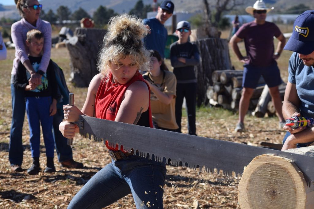
Alex, representing NAU Logging Sports, competes in the double-buck crosscut sawing event at the Choptober Fest competition hosted by the Colorado State University Logging Sports team in Fort Collins, Colorado, October 2023. Photo courtesy of Alex Williams
What inspires your love of forests and forestry?
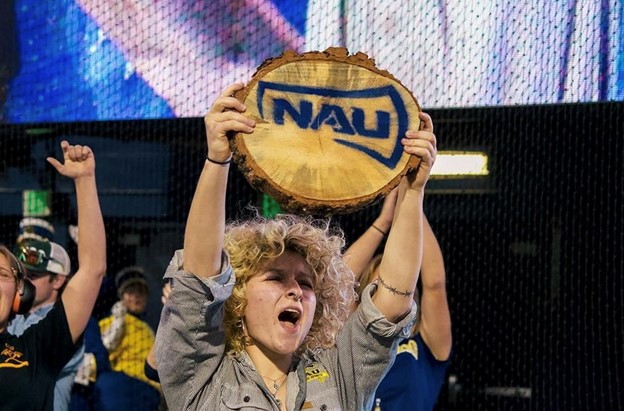
Growing up in the deep suburbs of Phoenix made me start to romanticize the great outdoors. During high school I enjoyed reading nineteenth-century nature writers like Henry David Thoreau, John Muir, and Ralph Waldo Emerson. This led me to choose forestry as my initial degree plan when I began attending NAU. Once I got here, I hiked often, and joined the Logging Sports team and Forestry Club; doing everything I could to stay outdoors. Even though I’m no longer a Forestry major, I continue to love forests and forestry, and I’m still somewhat involved in the NAU School of Forestry. I’m currently the Administrative Captain of the NAU Logging Sports team and work closely with SoF faculty to run the team.
Are you more of a cat person or a dog person…and why?
Sadly I’ve been cursed with severe allergies and cannot be around either of them. I’m a huge animal-lover and can only appreciate them from a distance. If I had to choose, I would say I’m more of a dog person. The allergies I get from “hypoallergenic” breeds are more bearable compared to the allergies I get from cats.